

Tievebaun Mountain
About Tievebaun Mountain
Tievebaun (Irish: Taobh Bán, meaning 'grassy slope') is a mountain located on the border of County Leitrim and County Sligo, Ireland. Its classifications include Arderin and Vandeleur-Lynam. Its height is 611 m (2,005 ft). The mountain is notable for its cliffs as well as the pinnacles on the eastern and northern sides, such as Eagle's Rock and The Hag's Leap. Tievebaun is the third-highest mountain in the Dartry Mountains, and ranks as the 254th highest mountain in Ireland. It is the highest independent peak in County Leitrim; however, the mountain's summit is only the second-highest point in the county, as the southeast ridge of Truskmore Mountain lies within Leitrim, at 631 m (2,070 ft).
Visitor Information
- Elevation
- 611 m
Getting There & Parking
Tievebaun Mountain is located in County Leitrim, roughly 171 km (2h 30m drive) from Galway and 231 km (3h 25m) from Dublin. Nearby highlights within a short drive include Cormac Reagh's Hole (1.3 km away).
Plan your visit to Tievebaun Mountain
How far is Tievebaun Mountain from Dublin and nearby hubs?
Estimated road-adjusted distances to Tievebaun Mountain: Galway (171 km, ~2h 30m drive), Belfast (203 km, ~3h drive), Dublin (231 km, ~3h 25m drive).
What else is near Tievebaun Mountain?
Top nearby stops include Cormac Reagh's Hole (1.3 km) , Truskmore (2.7 km) , and Truskmore SE Cairn (2.8 km) .
Tievebaun Mountain videos
Search on YouTube →
Tievebaun Mountain
EVERITHING BEST OF BEST!

Climbing TieveBaun Mountain 2021
Fergal McGrath Photography
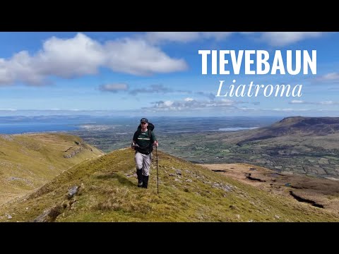
Tievebaun, Leitrim Hike. 4K, Boeing B-17G Crash Site from 1943. DJI AIR 3 Drone.
Mountain Mac
Things to do near Tievebaun Mountain
Cormac Reagh's Hole
 2.7 km
 2.8 km
 3.1 km
Gleniff Horseshoe Drive 2
Video 3.2 km
Gleniff Horseshoe Drive
 3.5 km
Keeloges Church
More in County Leitrim

More Peak in Ireland
See all →


Found Tievebaun Mountain helpful for your Ireland trip?
Support Ireland Gems